Gates Ventures
With an exhibition at the Qatar World Cup, they had an opportunity to put this priority in front of key decision-makers from across the planet.
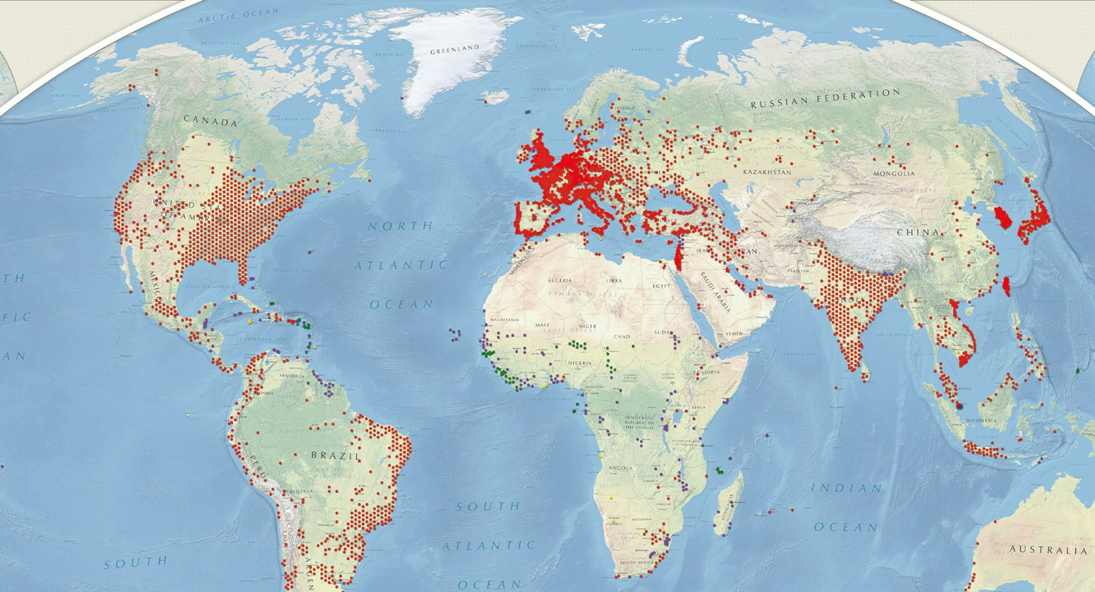
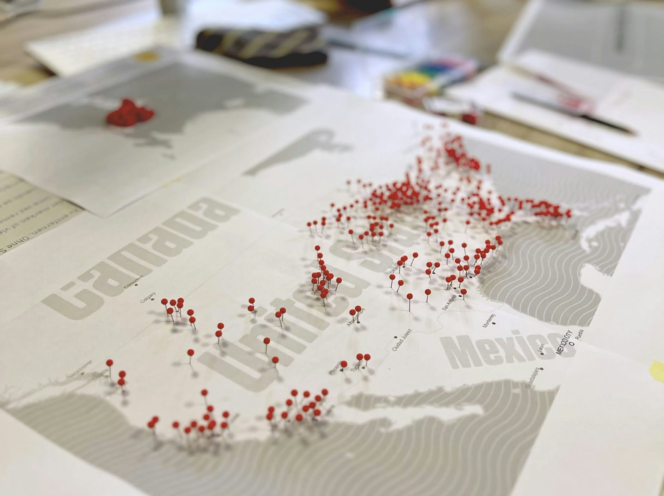
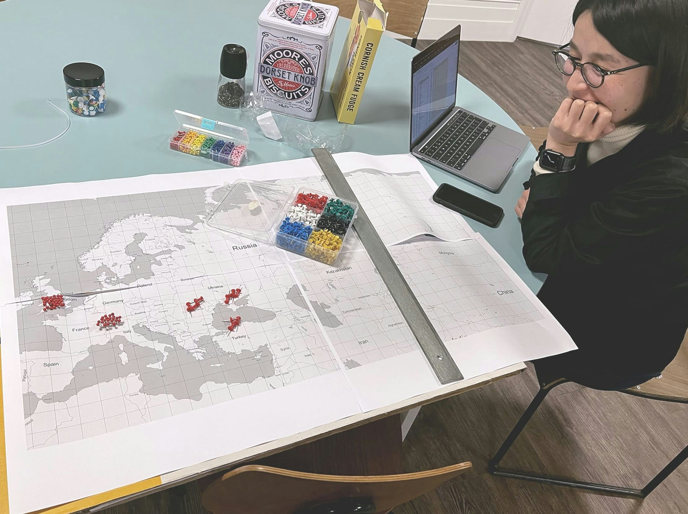
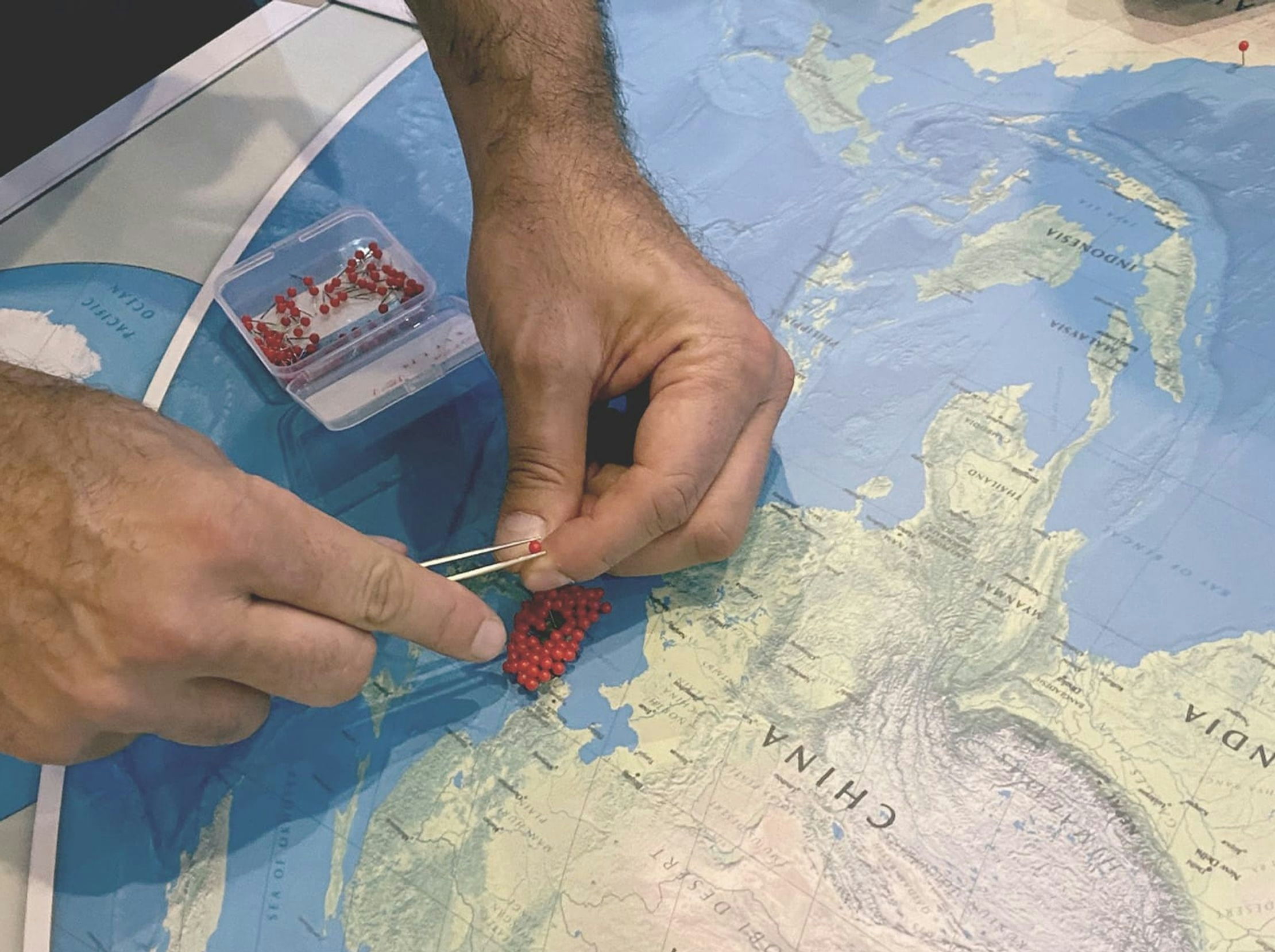
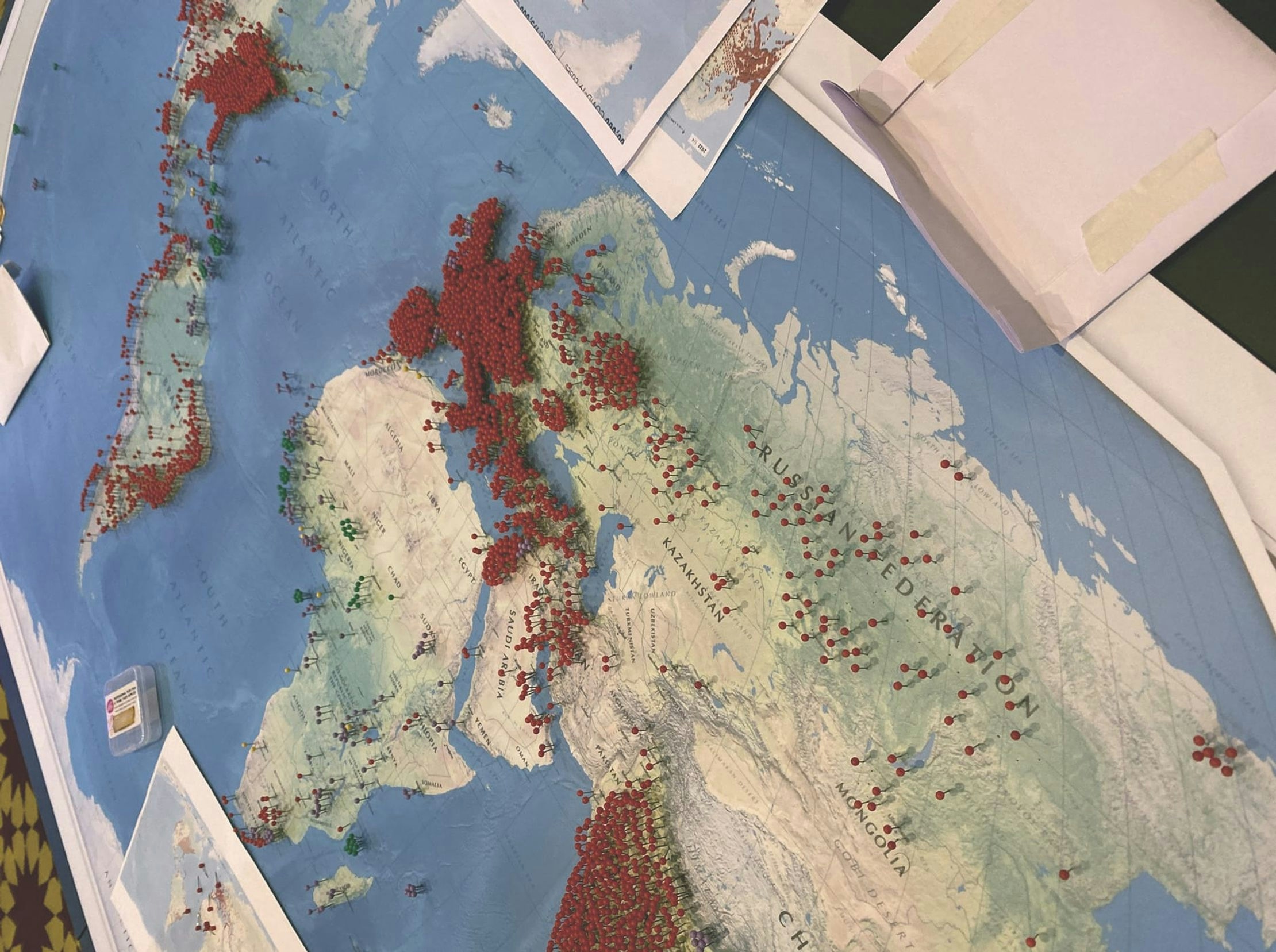
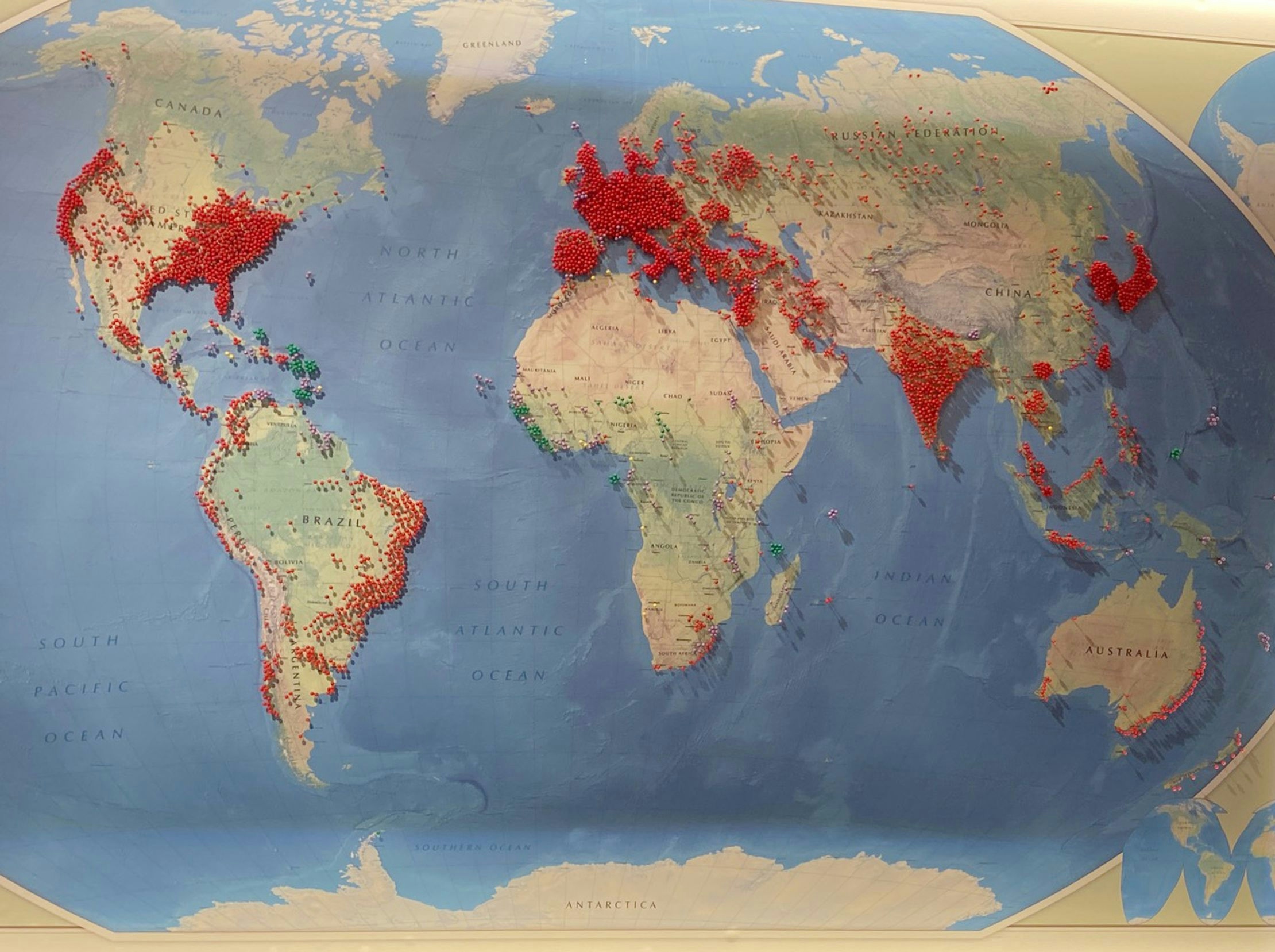
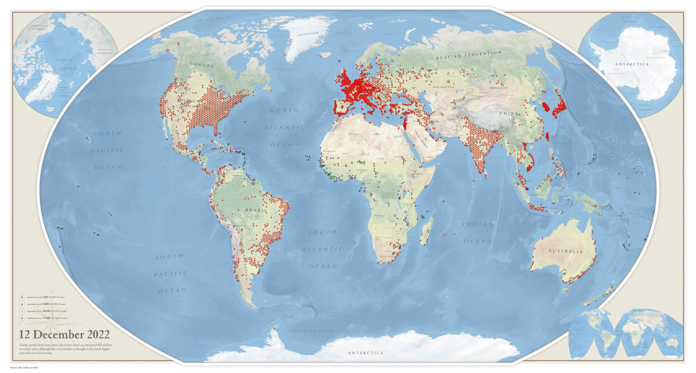
We produced two physical maps that used pins to represent cases of COVID-19, illustrating the speed and scale at which it spread globally. The first map showed 11 March 2020, the day WHO declared a pandemic. The second showed estimated cases on the first day of the exhibition.
Fitting hundreds of pins onto each map was a challenge, so we used QGIS, an open-source map-making tool, to create a basemap that maximised countries’ landmasses, creating more space to place pins.
We used four colours to represent different thresholds of COVID cases. On the sparser 2020 map, pins were placed either in areas of notable outbreaks or in capital cities. For the much busier 2022 map, we switched to using population density to guide pin placements.
The final contrast speaks for itself. What were once pockets of disease have now become vast clouds of contagion, with more than 600 million cases globally. A pointed warning that we cannot ignore the threat of future pandemics.
Get in touch:hello@beyondwordsstudio.com

We let people to explore the state of the world’s health through an interactive, personalised experience at London’s Science Museum.

Bringing the flavour… Three real-world data visualizations to inspire visitors at Kew Gardens’ ‘Full of Spice’ festival.