NATS
National Air Traffic Services (NATS), better known as the UK’s air traffic controllers, asked us to help them give the world a new appreciation of their fascinating work.
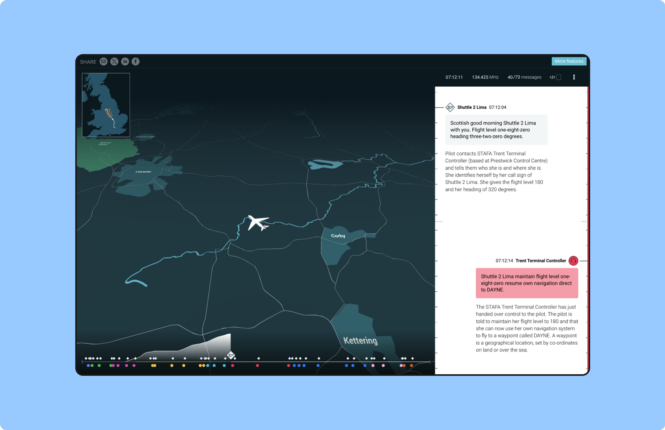
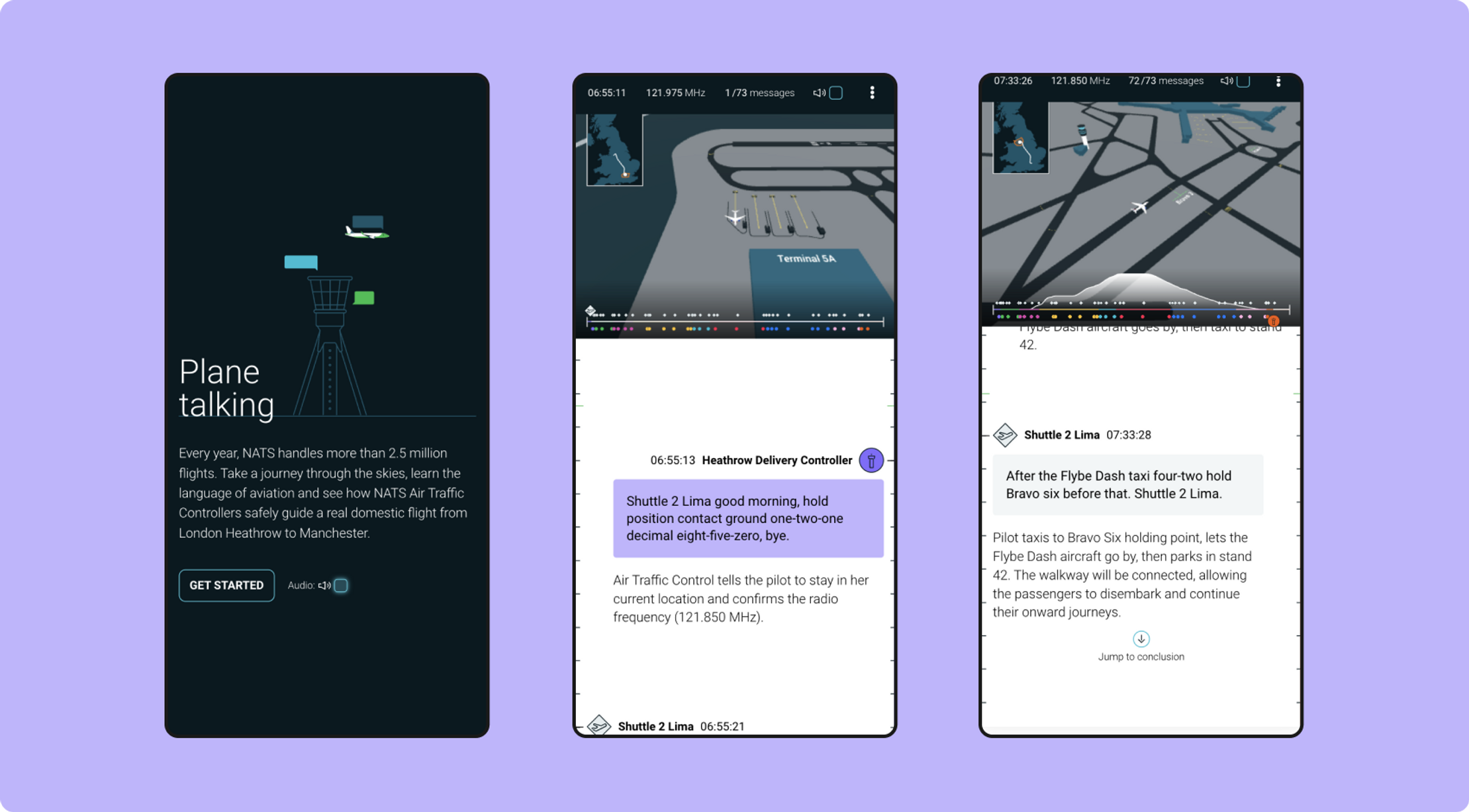
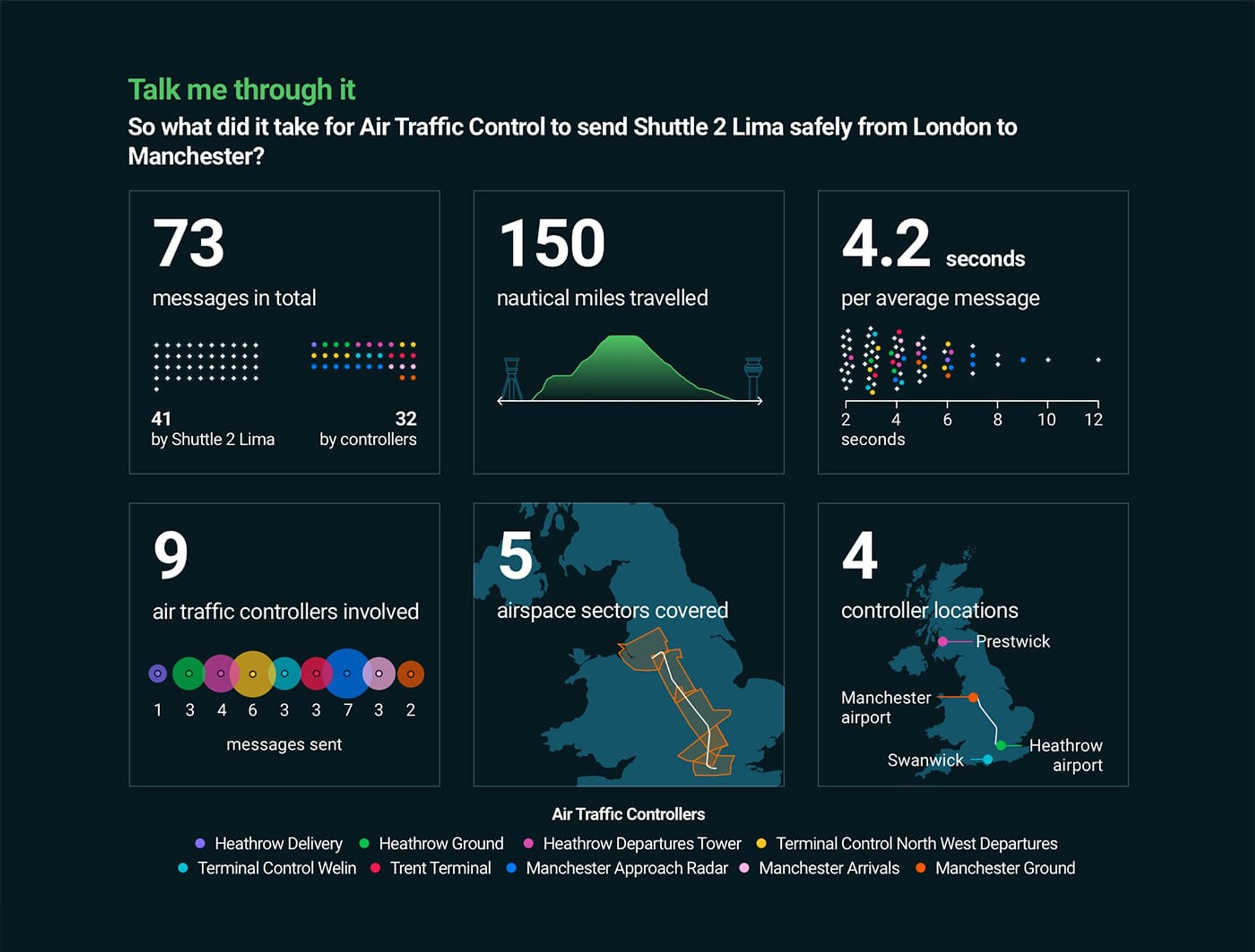
We used digital storytelling to recreate a real 40-minute flight from London to Manchester, taking the user of a journey of understanding into Air Traffic Control and air travel itself.
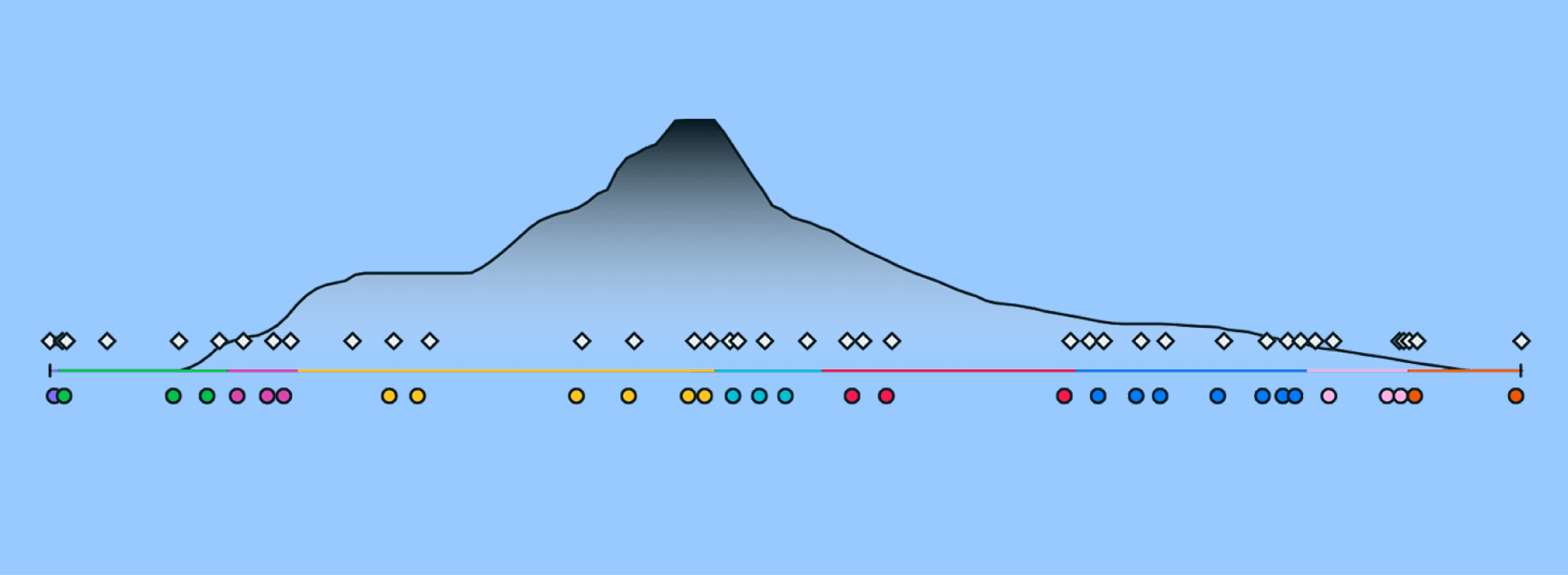
We designed the conversations between Air Traffic Control and the aircraft’s pilots to appear like a message thread. And we decoded each bit of dialogue with a handy explanation, helping people to learn the code words, abstract concepts and commands. Audio recordings gave the experience an even deeper level of realism.
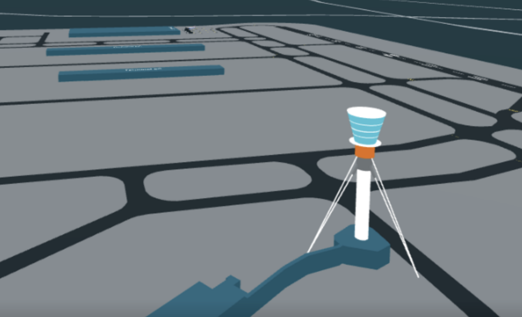
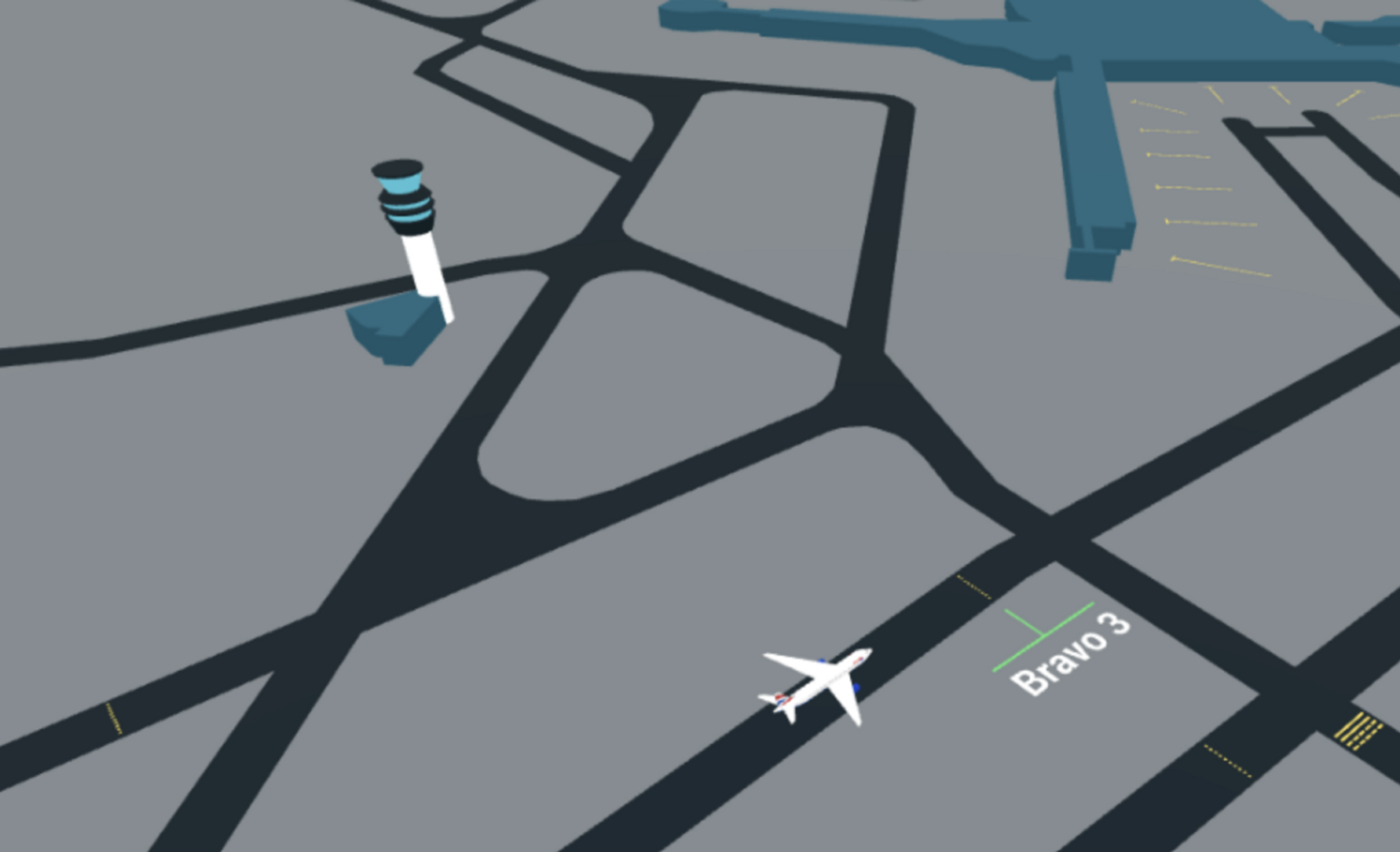
Alongside this scrolling audio-textual message thread, we built an interactive 3D recreation of the aircraft’s entire journey from Heathrow to Manchester airport. You’ll watch the aircraft taxi along the runway, take off into the air and fly above England’s cities.
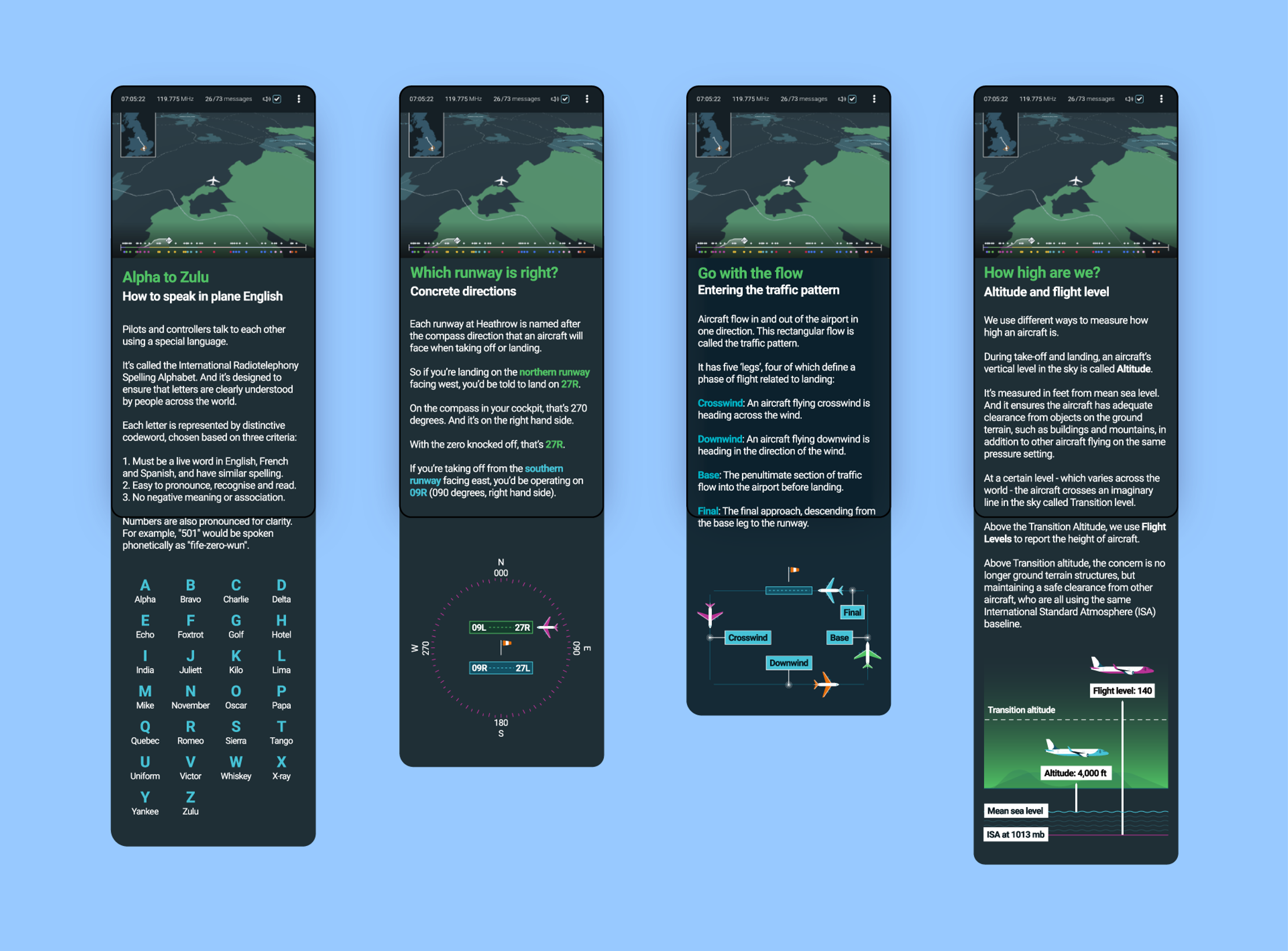
There are several mind-expanding stop-offs on our journey, too: animated explainers that deep dive into the aviation alphabet (Alpha to Zulu), the difference between ‘Altitude’ and ‘Flight level’ and how runways work.
Get in touch:hello@beyondwordsstudio.com

